I’m on vacation most of this week, like many of you, enjoying Oregon’s spring break. Who knew that OE is a violent wind in the Faroe Islands AND a Scrabble word? Yes, I’ve been busy…
We’ve got a little weather fun on tap the next 36 hours so I figure I should chime in…just a brief weather blog post before I head outside.
HIGHLIGHTS
- Portland hit 70° Monday afternoon, and today should be 7-10 degrees warmer. We’re going 79°, which is very dependent on how much high cloud cover we get. Regardless, it’s the warmest day of the season so far!
- The warm/humid atmosphere will be primed for scattered thunderstorms to pop up just about anywhere tomorrow. A few isolated storms could show up right at daybreak along the Coast/Coast Range.
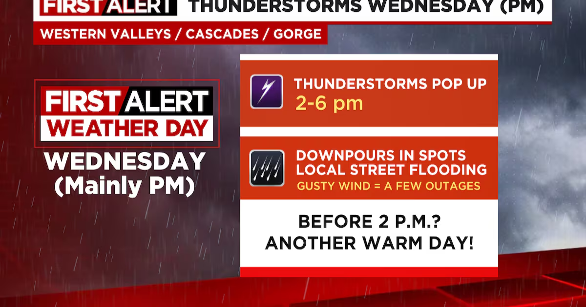
- But, more likely, scattered thunderstorms popup 2-6pm over and east of the I-5 corridor (Longview to Eugene). This includes the Gorge and Cascades
- It won’t last long because much cooler air surges inland by 5pm or so, cutting off the instability. Then it’s back to cool and showery through the weekend.
- For this reason, the weather gang has a First Alert Weather Day up for (mainly afternoon) Wednesday. Make sure you keep an eye on radar and have our app downloaded. Of course we’re on the air 4pm-7pm too.

Thunderstorms Wednesday(kptv)
DETAILS
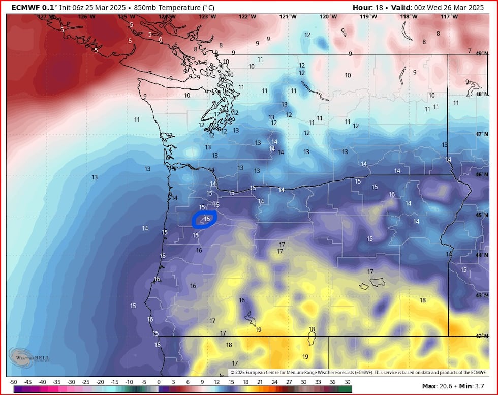
Today we’ve got an almost perfect setup for a record-setting warm day. Very warm atmosphere is in place overhead; the morning balloon sounding over Salem shows +12.8° (C) at 850mb (near 5,000′). The all-time warm 850mb temp in March is only 15.9°.

Wx Blog(kptv)
Models are forecasting further warming overhead with an afternoon/evening temp between +14 to +16!
(kptv)
So we’ve got close to a record-setting atmosphere in place. Easterly (offshore) wind flow has begun with gusts 30-40 mph at Vista House in the Gorge; that’s ingredient #2 and it’ll continue through midday Wednesday. The 3rd element we need to maximize heating in spring is sunny skies. But there IS a lot of high cloud cover streaming overhead so that isn’t “perfect”. This makes me think we won’t hit that 80° record. Still, I figure somewhere between 75-79° is likely today. Enjoy! The “thermal trough” or lowest surface pressure is in the western valleys, so the extremely warm temps won’t make it to the beaches today.
THUNDERSTORMS WEDNESDAY
Tomorrow we’ve got a classic setup for thunderstorms west of the Cascades. These aren’t the “one flash and done” storms we get in spring/fall that follow a cold front. These will be the warm-season/summer type storms that come from the south and can be quite strong. As you have probably noticed, it’s relatively humid with this warm spell due to leftover moisture from Sunday’s warm front. During the afternoon/evening Wednesday a much cooler airmass will arrive first overhead, then down at the lowest elevations. That makes the airmass unstable (until the cooler air arrives below). The 500mb map is perfect for us showing southerly flow ahead of the upper-level trough tomorrow afternoon. This is also “diffluent” flow up high which brings rising motion.

(kptv)
With convection (scattered heavy showers and thunderstorms), models are always going to struggle with details. Some models are thinking the main action stays over the Cascades or east of I-5. Others, like this NAM model, bring widespread storms over the lowlands around the metro area during the evening commute Wednesday. That model may be terrible at snow forecasting, but it handles severe warm-season weather much better.

NAM model: 5pm Wed(kptv)
Clearly some of us will get a big soaking tomorrow afternoon and others won’t. That’s normal with convection. See the NAM precip forecast

(kptv)
Our GRAF model shows the wind switch from warm easterly to chilly onshore flow mid-late afternoon. The change will be dramatic…get the jackets out again…

(kptv)
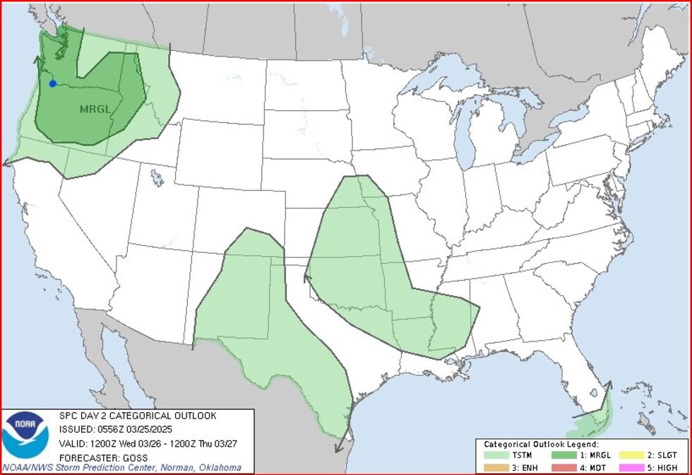
I think that covers it, I see SPC has a MARGINAL risk for severe thunderstorms tomorrow over the region. No, even I don’t know who ever came up with those categories. MARGINAL vs. SLIGHT. Color coding makes sense though.
(kptv)
Finally, remember our weather app will send you alerts if a Severe Thunderstorm Warning is issued in your area.

(kptv)
Copyright 2025 KPTV-KPDX. All rights reserved.