INDIANAPOLIS —
Near-record highs before high wind and severe storms
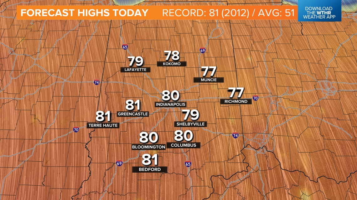
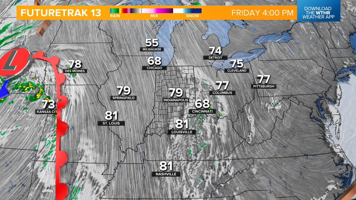
TGIF! Before the high wind and severe weather potential arrive, please know that today in Indiana will be very mild, bright and breezy. Make plans to enjoy a summer-like high temperatures approaching 80° (daily record is 81° set in 2012) and what looks like our warmest day since late October. It will becomes breezy this afternoon with gusts over 30 mph, with the worst of the wind yet to come. But there’s absolutely no weather worries during daylight hours, so please go enjoy.

This is a classic mid-March mid-latitude cyclone bringing us near-record warmth and eventually bringing us below-average temperatures and possibly snowflakes. The strengthening low pressure system has a broad, strong windfield that’s prompted High Wind Warnings, High Wind Watches and Wind Advisories over a large swath of the lower 48, including Indiana.

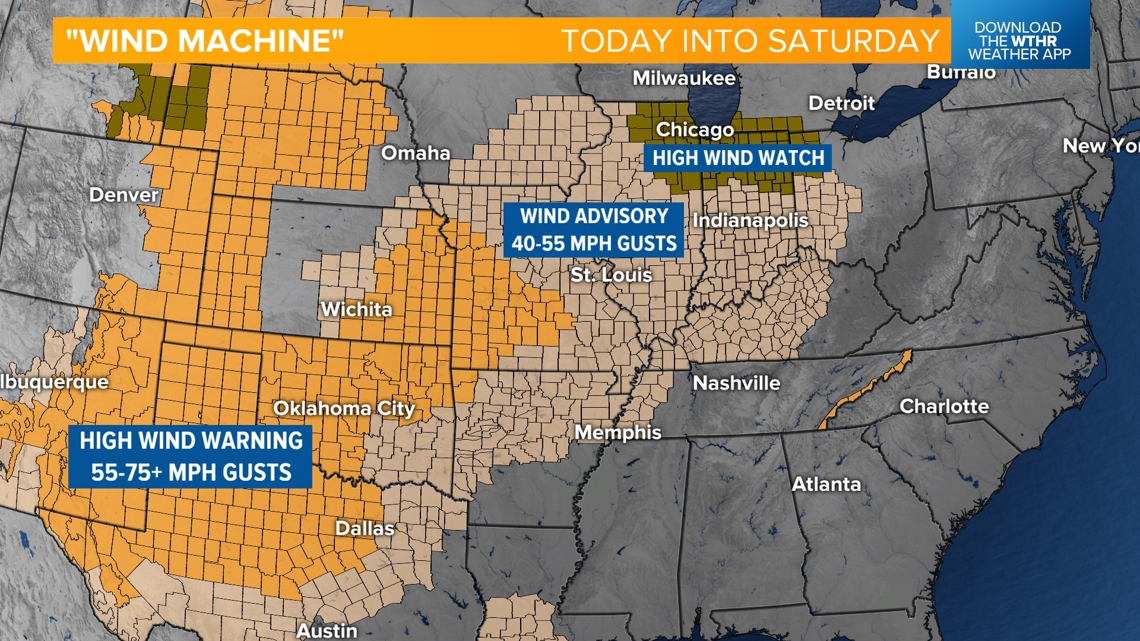
Even without the line of thunderstorms late tonight/early Saturday morning and again later Saturday, we’ll have to deal with strong, possibly damaging, non-thunderstorm “gradient” wind gusts of 40-55+ mph.


A Wind Advisory is in effect for central Indian between 5 p.m. today and 4 p.m. Saturday for the expectation of those strong non-thunderstorm wind gusts. These winds could cause power outages, downed trees and difficulty driving, especially for those in high-profile vehicles like trucks and SUVs. Please be cautious if you driving in these conditions, and be prepared for the potential of power outages.

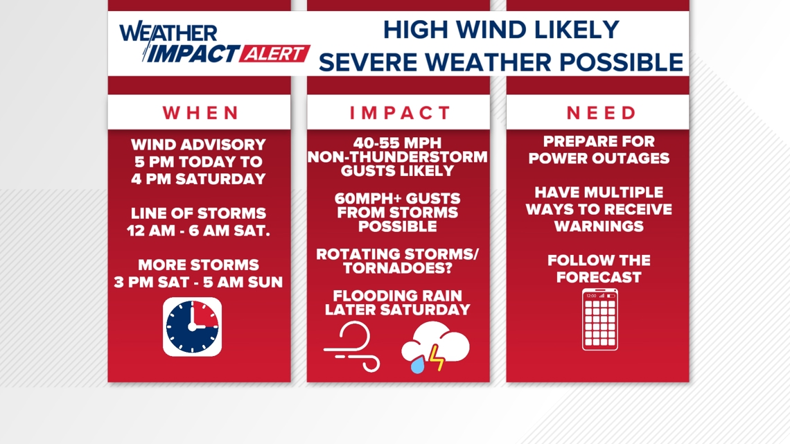
We want you to be aware of the multitude of impacts this storm system brings us and keep you prepared before, during and after the storm hits.
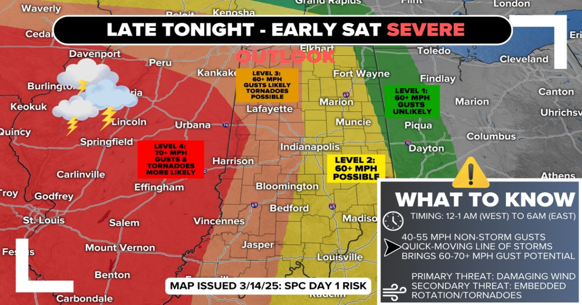
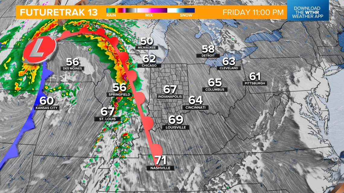
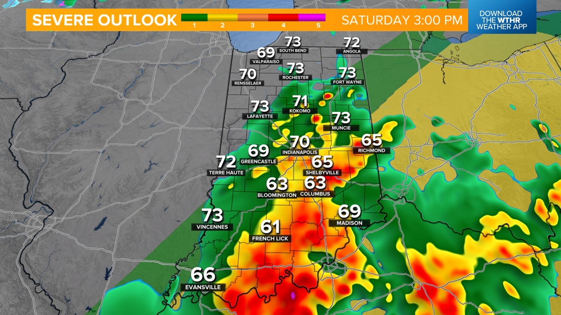
All of Indiana is at risk tonight/early Saturday morning from a quick-moving (50+ mph) line of storms that will be feeding off the robust windfield we discussed. Based on latest hi-res computer modeling, it does appear the line will be arriving about 1-2 hours slower.


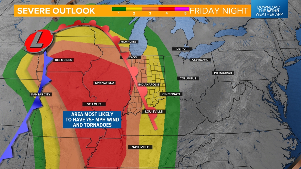
Storms are going to be very slow to initiate, but we fully expect “explosive” development in Iowa and Missouri between 5-7 p.m. EDT. These will likely be supercells that eventually congeal into a line or multiple lines, producing a large area of damaging to destructive wind swaths within the Level 4 (out of 5) risk area in Illinois, Missouri, Iowa and western Kentucky/Tennessee.

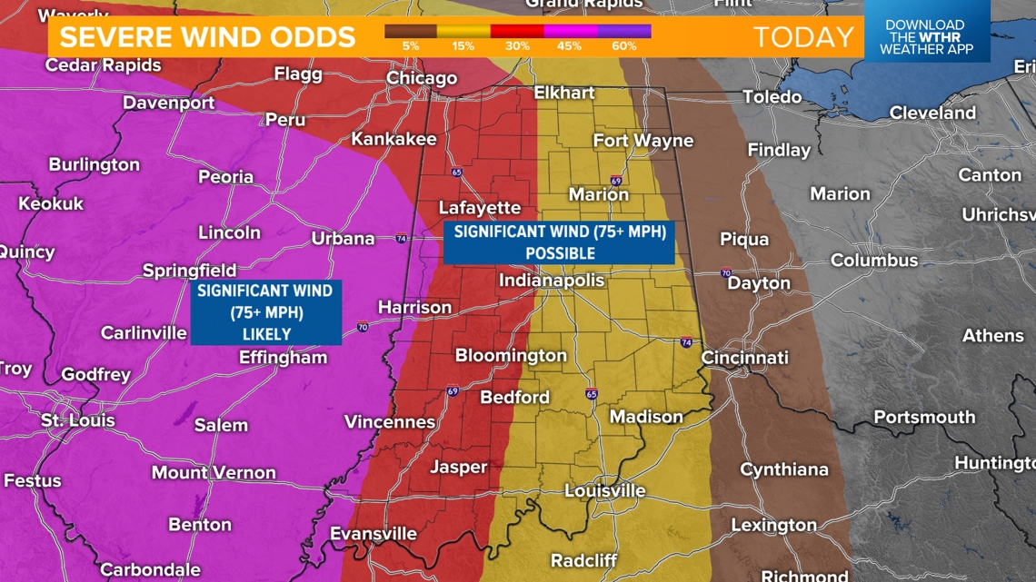

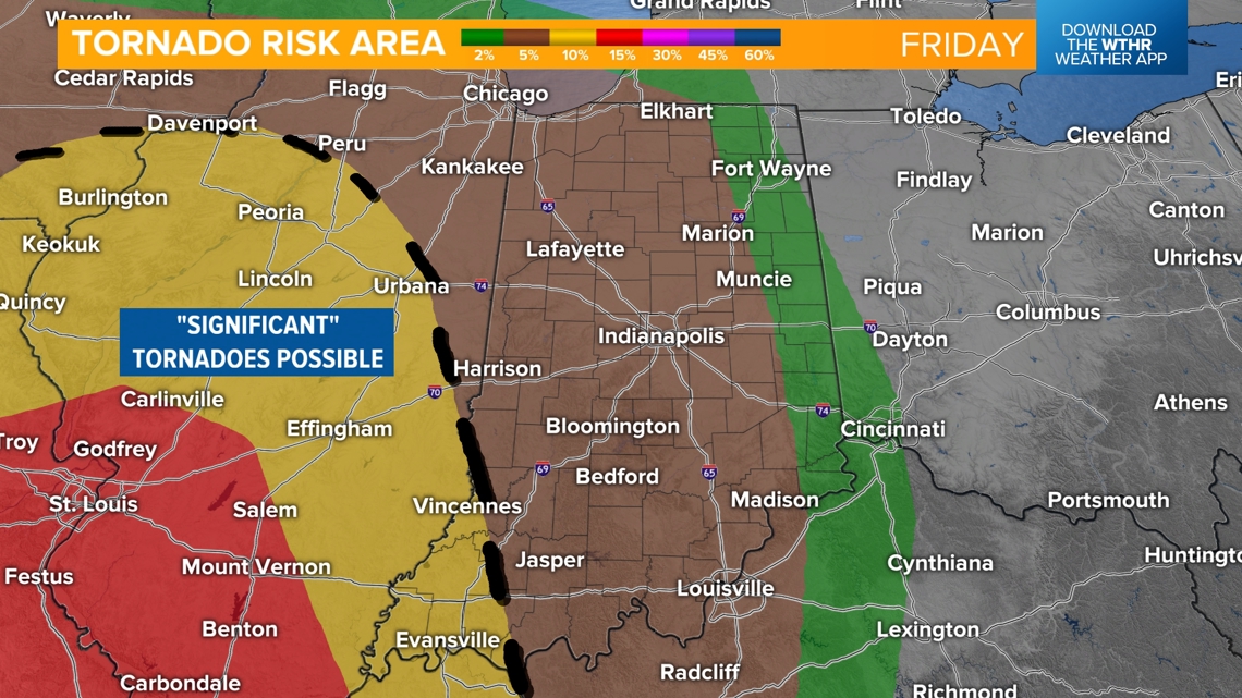
That’s where windshear and atmospheric instability will be maximized. It’s not only a zone of higher probability for “significant” (75+ mph) wind gusts but also a higher probability for potentially significant tornadoes, too.
As we’ve discussed for many days now, this line will be “weakening” some as it moves east and the atmosphere stabilizes some during the overnight/early morning hours. Unfortunately, it may not weaken fast enough to prevent Indiana from 60+ mph wind gusts, areas of rotation in the line and/or some tornadoes.


We expect, at minimum, there will be either a Severe Thunderstorm and/or Tornado Watch issued for parts of the state. At worst, there could be multiple Tornado Warnings due to rotation within the line of damaging wind storms as it moves east overnight.
The odds of severe weather are higher in western Indiana versus eastern Indiana, but we should all remain diligent until we can give you the all clear Saturday morning.
We can’t stress enough that overnight severe weather/tornadoes are even more dangerous due to many people sleeping and not being Weather Aware.
We urge you all to know the risks from overnight severe weather, have multiple ways to receive any warnings issued (NOAA weather radio, cellphone, TV) and be prepared to take shelter if needed.
Based on latest data, it appears the leading of the storms reaches the Illinois/Indiana border between 12-2 a.m, the central part of the state (including the Indy metro area) between 2-3 a.m and the Indiana/Ohio border between 6-7 a.m.

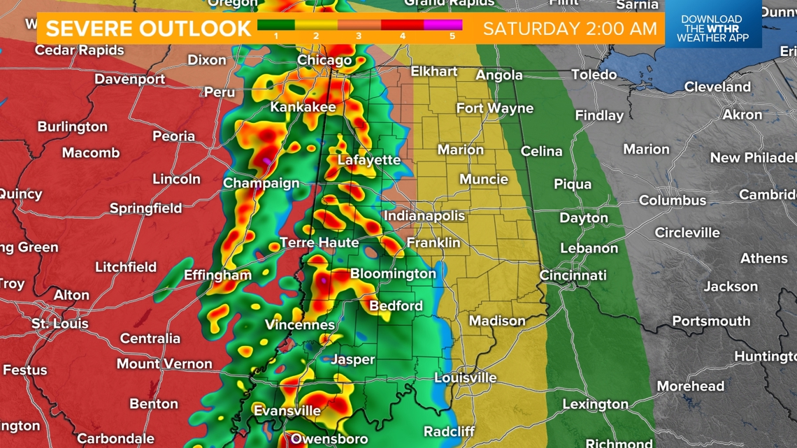

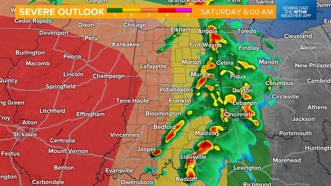
These times, and storm impacts, are subject to change. We’ll continue to fine-tune and update.
Don’t be surprised to be awakened by high wind and/or your weather radio or phone from severe weather warnings.
Yes, though there’s much greater uncertainty on how severe, if at all, they’ll be. It’s very possible that main convective boundary could be displaced farther east-southeast to prevent much of the WTHR viewing area from having any severe weather. But we can’t make that call right now.

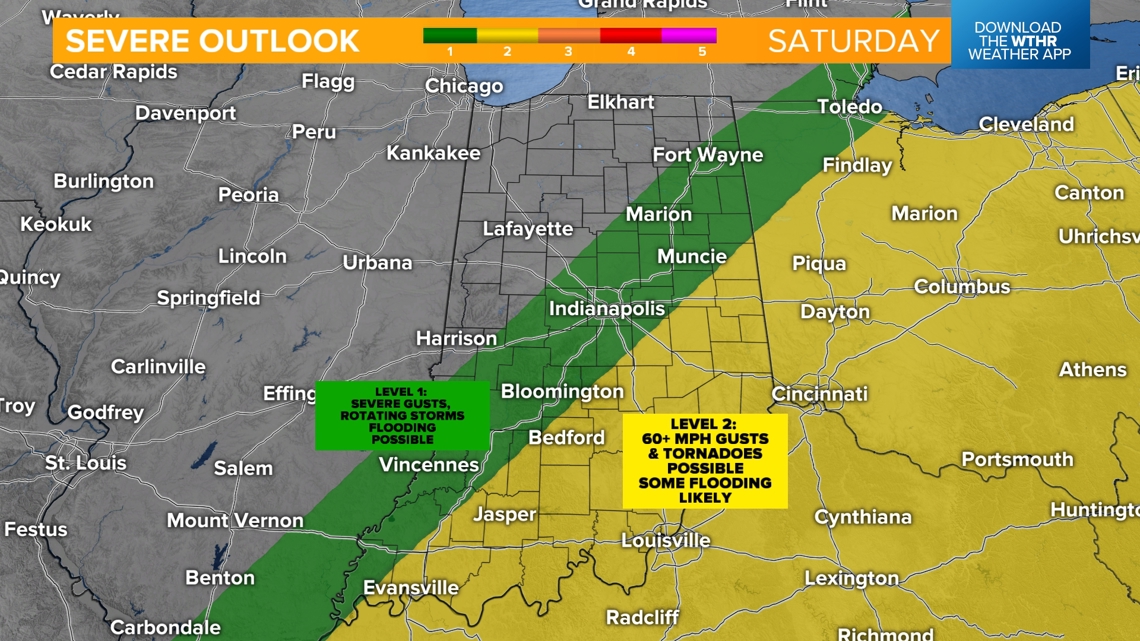

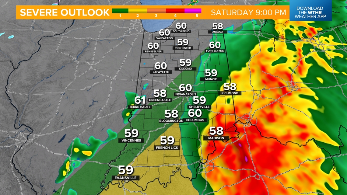
The southeastern part of Indiana is under a Level 2 (out of 5) risk of severe weather. Flooding rainfall seems more likely than severe gusts and/or tornadoes. But we need to be Weather Aware Saturday afternoon/evening, too.
Modeling suggest a renewal of rain/thunderstorms by 3-4 p.m. and and expansion of heavy rain a between Indy and Cincinnati. Check back for updates.

Yes. The air will be cold enough to support snow showers mixing with rain shower in what will be a rather blustery finish to the weekend. Windchills near 30° Sunday morning make it “feel” 50° colder than the near-record high today. Temperatures hold steady in the 40s Sunday.


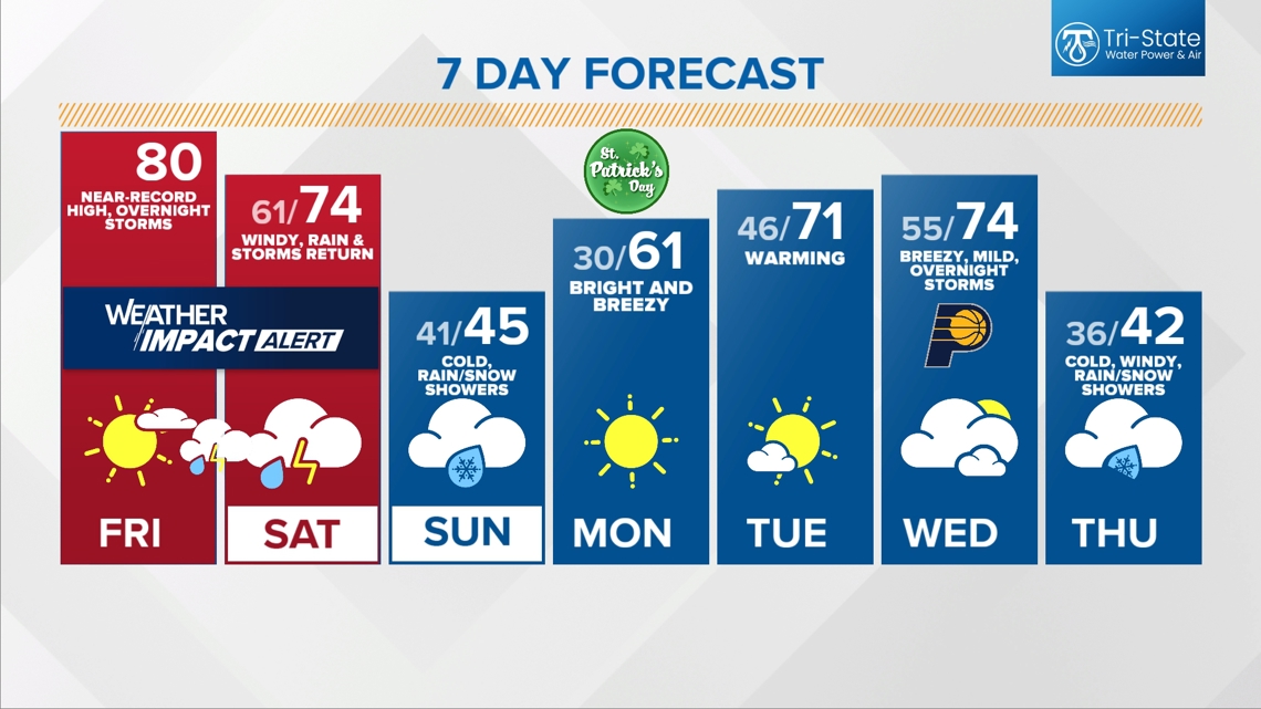
But we’re back to bright early next week and back to mild before a strong storm system arrives Wednesday into Thursday.
Please check back for updates and know that will we be updating on-air and online overnight into Saturday morning.