INDIANAPOLIS (WISH) — Tornado watches were issued Friday night for parts of central and southern Indiana overnight as a strong storm system approaches the state.
Two tornado watches have been issued through 4 a.m. ET for these Indiana counties: Benton, Clay, Daviess, Fountain, Gibson, Greene, Knox, Martin, Montgomery, Owen, Parke, Pike, Posey, Putnam, Spencer, Sullivan, Tippecanoe, Vanderburgh, Vermillion, Vigo, Warren and Warrick.
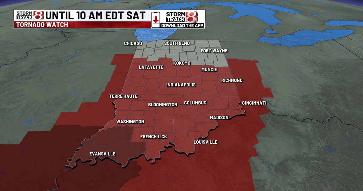
The tornado watch that is in dark red in southwestern Indiana is labeled as a ***PARTICULARLY DANGEROUS SITUATION*** type of watch. This means the threat and confidence level of significant tornadoes (EF-2+) is on the higher side. It is also the first time since November 2013 that any part of the Hoosier state has been under a PDS tornado watch.
Dozens of Illinois counties also are part of that same tornado watch.
A tornado watch has also been extended until 10 AM EDT for central, southern, and eastern Indiana.
We also have a severe thunderstorm watch that will be in effect until 9 AM EDT Saturday morning for northern Indiana.

The U.S. Storm Prediction Center says a few tornadoes are likely, along with scattered hail up to tennis ball-sized. Widespread wind gust up to 80 mph also are likely.