Getting your Trinity Audio player ready…
The Butler County Emergency Management Agency (EMA) hosted a weather webinar on March 14 at Lurleen B. Wallace Community College, where National Weather Service officials warned of potential severe storms set to impact the region Friday night and Saturday.
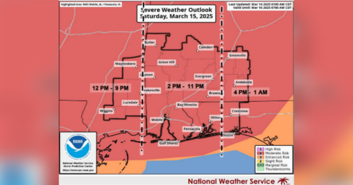
“We’ll have multiple rounds of severe thunderstorms going from tonight to tomorrow, with our main event focusing on Saturday,” said Jessica Chase with the National Weather Service (NWS) in Mobile. “The potential is going to be there for strong long-track tornadoes, damaging winds and large hail over our whole area.”
According to Chase, isolated severe storms are possible as early as Friday night, primarily west of I-65, with damaging winds and large hail as the main threats. Although the weather service does not expect a lot of overnight storms, Chase notes anything that develops has the possibility to become severe.
The primary concern, however, is for Saturday, when conditions are expected to worsen throughout the day. Forecasters anticipate isolated supercells forming by late morning, followed by a squall line moving from west to east by late afternoon and into the night.
“There is a high confidence for significant severe storms on Saturday,” Chase said. “However, if storms develop overnight, they could impact conditions leading into the main event.”
Butler County EMA Director Rosie Till emphasized the importance of preparedness.
“The National Weather Service sends us information as best as they can predict, and we come together as a community to try to mitigate things the best we can before it gets here and deal with it when it does,” she said.
Till confirmed that the local EMA office will provide updates as the situation develops. Residents are encouraged to stay weather-aware and have multiple ways to receive alerts.