Sunday, March 16, 2025 11:33AM

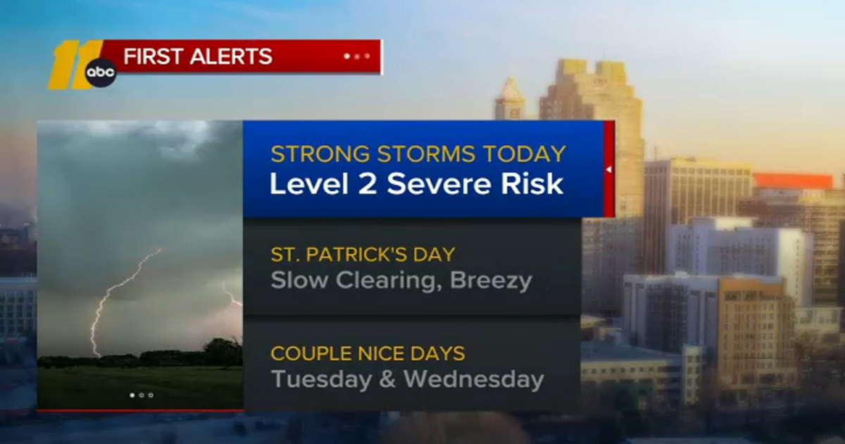
There is a level 2 of 5 risk for severe storms across central North Carolina.
RALEIGH, N.C. (WTVD) — Lines of thunderstorms will move across the Triangle late Sunday morning and early afternoon.
There is currently a level 2 out of 5 severe risk for severe storms, which includes damaging wind gusts, flash flooding and isolated tornado.
The storms are expected to move into central North Carolina between 10 a.m. and 8 p.m., with rain totals reaching 1 to 2 inches.
Download the ABC11 App for Weather Alerts and Breaking News
ABC11 meteorologists say that while some instability and upper-level support may bring a risk of severe storms, widespread severe weather is not expected.
Gusty winds have already begun and will continue throughout the day as the pressure gradient increases, leading to gusts of 35 to 45 mph at times.
A Wind Advisory is in effect across the viewing area from 8 a.m. to 8 p.m. on Sunday, and a Tornado Watch is also in effect for some southern counties until 2 p.m.
As the initial frontal boundary slows along the coast, showers and thunderstorms will not be as severe across the mainly eastern portions of the viewing area.
The cold front will move through the region late Sunday, bringing cooler, drier air to start next week.
Severe Weather Hits Multiple States
These same lines of storms are sweeping east across the region bringing the threat of strong tornadoes, damaging wind gusts, and large hail. It has already claimed the lives of several people after hitting parts of Missouri, Texas and Arkansas overnight.
Tornado watches are in effect for several states.
There were 23 reported tornadoes overnight across four states – Missouri, Arkansas, Illinois, and Mississippi as the severe weather outbreak continues into Saturday. Winds gusted up more than 80 mph causing damage in the Midwest from Missouri to Wisconsin.
Looking Ahead
On St. Patrick’s Day, it will be noticeably cooler with drier air. Highs will be in the low 60s
Highs will be in the 70s on Tuesday.
Another storm will begin swinging across the central part of the US Wednesday. This will trek eastward overnight into Thursday. You may see an isolated shower along the front.
ABC News contributed to this report.
Copyright © 2025 WTVD-TV. All Rights Reserved.