SHREVEPORT, La. (KTAL/KMSS) – It will be a very warm and humid day as the ingredients for severe thunderstorms will build. An area of low pressure moving in before sunset will trigger scattered storms that could become severe between 5 p.m. and midnight.

It will be a mild and breezy morning with temperatures in the 50s at sunrise. The south breeze will be pushing Gulf humidity into the region, and highs will wind up in the low to mid 80s under partly cloudy skies this afternoon.

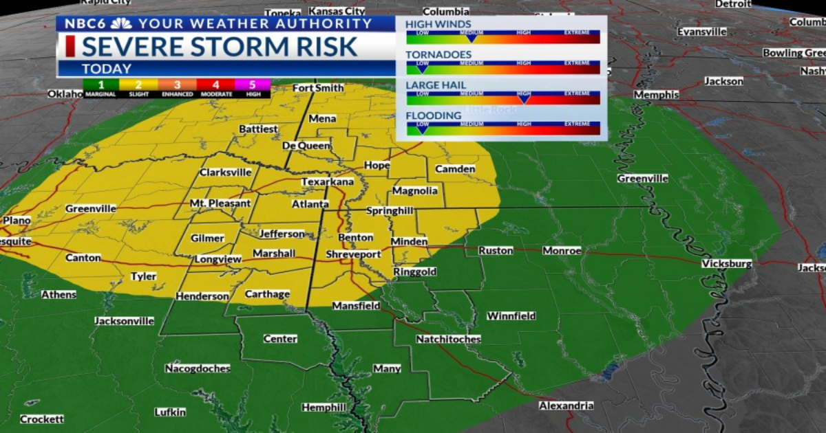
The warm and humid air will be in place as an upper level disturbance swings through late this afternoon into the evening. A focused area of storms will likely develop close to the I-30 corridor around 5 or 6 p.m. Severe thunderstorms capable of quarter to golf ball sized hail will then sweep across the remainder of the I-30 corridor, and perhaps as far south as I-20 between 7 p.m. and midnight. A few damaging wind gusts will be possible, and a brief tornado can’t be ruled out. Storms are most likely in the level 2 ‘Slight Risk’ area outlined in yellow by the Storm Prediction Center.

Futurecast outlook for the next 36 hours
Any severe weather will most likely end by midnight with clouds clearing after midnight. Our very warm pattern will continue Thursday with highs in the low to mid 80s. Friday will be a windy day with highs in the upper 70s and low 80s.

There is some good news on the severe weather front. What had looked to be a significant severe weather threat arriving late Friday is now expected to develop east of the ArkLaTex Friday evening into Friday night. While some of the areas are outlined in the Storm Prediction Center’s outlook for Friday, the trend of the outlook pushing east is likely to continue. Our weather will cool a few degrees over the weekend, but the weekend looks pleasant and likely dry with highs in the 70s.

Copyright 2025 Nexstar Media, Inc. All rights reserved. This material may not be published, broadcast, rewritten, or redistributed.
For the latest news, weather, sports, and streaming video, head to KTALnews.com.