The tornado warnings that were in effect for Marion and Franklin counties have been allowed to expire, and new severe thunderstorm warnings have been issued for these areas. Similar to last time, there are two separate warnings for the same cluster of storms. Here are the graphics for these warnings:
Strong winds and hail are occurring with these storms. Additionally, these storms could strengthen more as they move across western AL. We will continue to closely monitor this area.
Here are the full messages from the NWS:
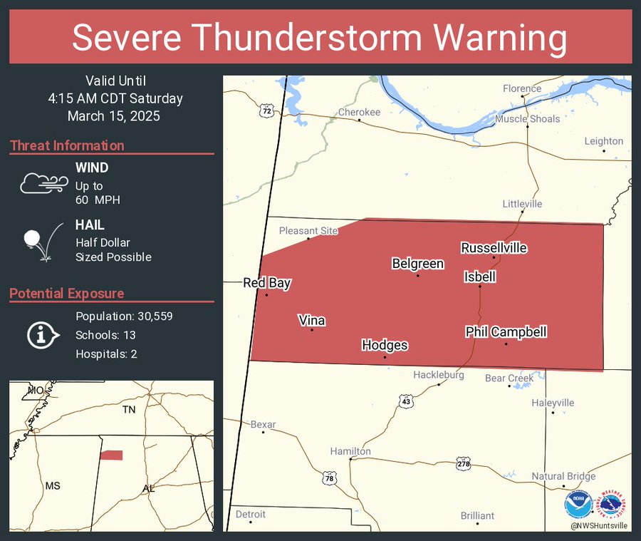
The National Weather Service in Huntsville Alabama has issued a
* Severe Thunderstorm Warning for…
Franklin County in northwestern Alabama…
* Until 415 AM CDT.
* At 319 AM CDT, a severe thunderstorm was located 9 miles southeast
of Red Bay, moving northeast at 35 mph. At 315 AM, quarter size
hail was reported in Hodges Alabama.
HAZARD…60 mph wind gusts and half dollar size hail.
SOURCE…Radar indicated.
IMPACT…Hail damage to vehicles is expected. Expect wind damage
to roofs, siding, and trees.
* Locations impacted include…
Red Bay, Cedar Creek Reservoir, Atwood, Tharptown, Duketon,
Russellville, Rockwood, Vina, Halltown, and Hodges.
PRECAUTIONARY/PREPAREDNESS ACTIONS…
For your protection move to an interior room on the lowest floor of a
building.
Large hail, damaging wind, and continuous cloud to ground lightning
are occurring with this storm. Move indoors immediately. Lightning is
one of nature’s leading killers. Remember, if you can hear thunder,
you are close enough to be struck by lightning.
Torrential rainfall is occurring with this storm, and may lead to
flash flooding. Do not drive your vehicle through flooded roadways.
A Tornado Watch remains in effect until 1000 AM CDT for north central
and northwestern Alabama.
—– —– —–
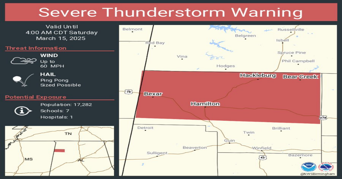
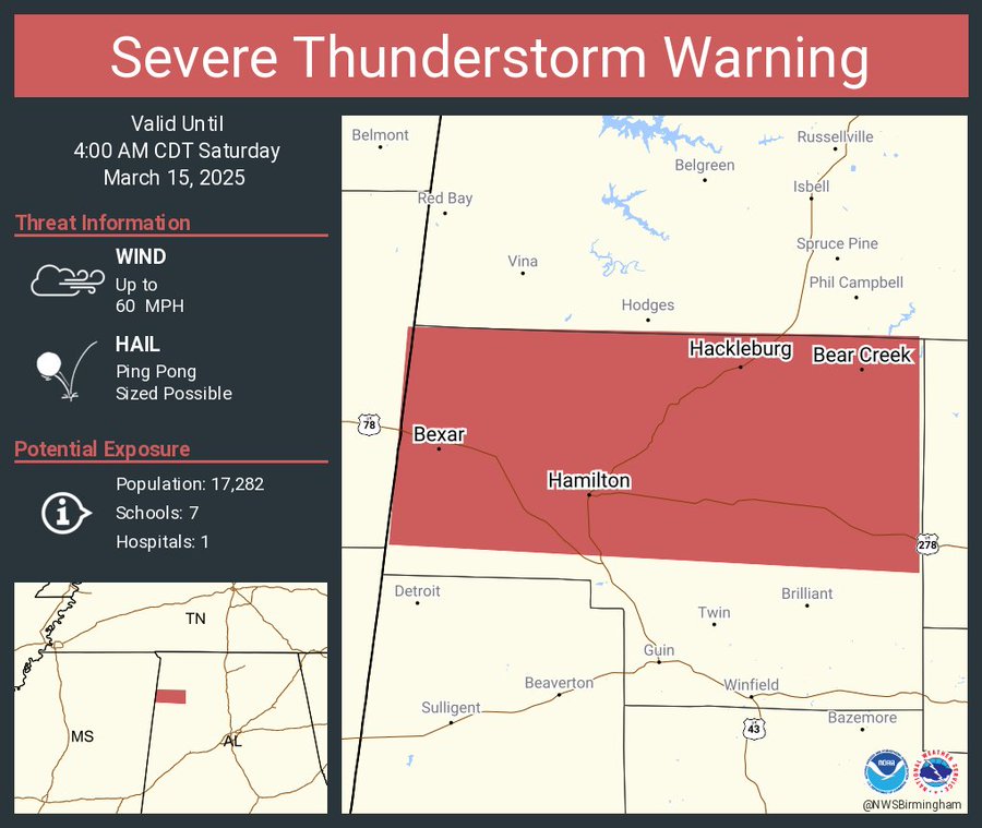
The National Weather Service in Birmingham has issued a
* Severe Thunderstorm Warning for…
Marion County in northwestern Alabama…
* Until 400 AM CDT.
* At 316 AM CDT, a severe thunderstorm was located over Tremont, or
near Fulton, moving northeast at 55 mph.
HAZARD…Ping pong ball size hail and 60 mph wind gusts.
SOURCE…Radar indicated.
IMPACT…People and animals outdoors will be injured. Expect hail
damage to roofs, siding, windows, and vehicles. Expect
wind damage to roofs, siding, and trees.
* Locations impacted include…
Tessner, Shottsville, Pearces Mill, Rankin Fite Airport, Brinn,
Hackleburg, Upper Bear Creek Reservoir, Weston, Lake Buttahatchee,
Bear Creek, Hamilton, Bexar, Pigeye, and Piney Grove.
PRECAUTIONARY/PREPAREDNESS ACTIONS…
For your protection move to an interior room on the lowest floor of a
building.
A Tornado Watch remains in effect until 1000 AM CDT for northwestern
Alabama.
Category: Alabama’s Weather, ALL POSTS, Severe Weather, Social Media