(KIMT) — Expect a warm and windy St. Patrick’s Day with highs in the mid to upper 60s under a mostly sunny sky.


As a low pressure system passes overhead, a tightening pressure gradient will result in increased wind speeds. Southerly winds could gust up to 40 MPH at times Monday, but will eventually start to relax into the evening.

Another warm, but slightly cooler day, is slated for Tuesday before some big changes arrive into early Wednesday morning.
A Winter Storm Watch with the potential for BLIZZARD conditions has been hoisted for nearly all of southeast Minnesota and North Iowa. This alert will go into effect at 4 AM Wednesday and last through 1 AM Thursday.

An upper level low is forecast to eject out of the Rockies and move northeastward into the Upper Midwest early Wednesday morning. Precipitation should start as a mixed bag with rain, snow, and sleet all possible due to temperatures hovering slightly above freezing in spots.

As the day wears on, evaporative cooling will take over, allowing temperatures to slide below the freezing mark, resulting in a complete changeover to snow for all by Wednesday evening.

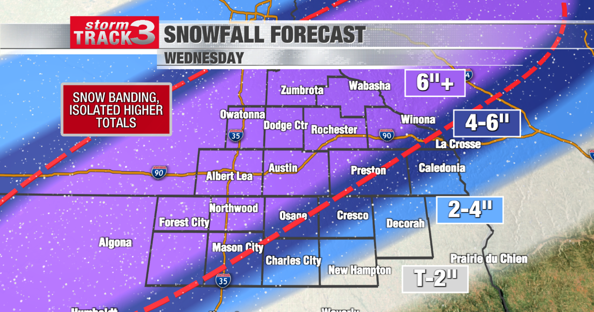
During the day Wednesday, a moderate to heavy snow band could set up somewhere over southeast Minnesota and North Iowa. This snow band will produce isolated higher totals while others outside of the snow band will not see much snow. The location and duration of this snow band, as well as the system as a whole, are still huge questions that will be hammered out over the next 48 hours.
A first call forecast shows a broad swath of six or more inches of snow through the heart of southeast Minnesota and North Iowa.

Winds are forecast to gust up to 55 MPH at times Wednesday, which could lead to BLIZZARD conditions, and therefore difficult travel conditions.
Post-winter storm, the First Day of Spring (Thursday) will feature much drier and cooler conditions. In fact, due to the anticipated snowpack, temperatures should remain below average for quick some time before the snow all melts away.