COLUMBIA, S.C. — A powerful cold front will move through South Carolina today, bringing showers, thunderstorms, and gusty winds. Some of these storms may be severe, with the potential for damaging winds and even a few tornadoes.
The front will continue its eastward movement, allowing drier air to settle in for the first half of the workweek. Two weaker cold fronts are expected to pass through on Thursday and Saturday, though these systems will bring only limited chances of rain.
Severe Weather Threat Today
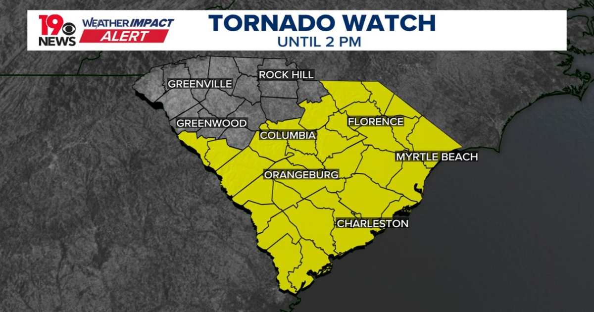
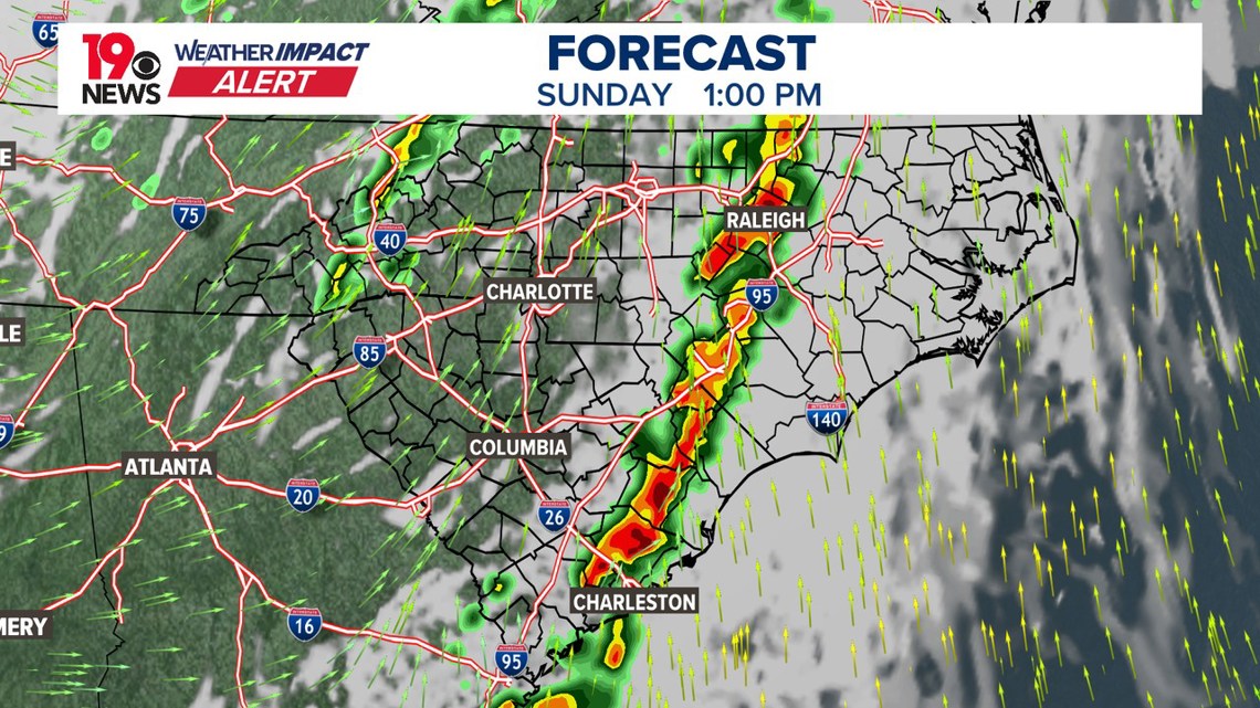
A strong cold front will push through, bringing a line of showers and thunderstorms, some of which may be severe. The Storm Prediction Center (SPC) has placed most of South Carolina under a slight risk (2/5) for severe weather, meaning damaging wind gusts and isolated tornadoes are possible.


Rain chances will increase from west to east, particularly after 8 AM as the main line of storms approaches. Temperatures have remained elevated overnight due to warm air advection ahead of the front, sitting in the mid to upper 60s. This has led to widespread low clouds and strong winds in the lower atmosphere. As the front moves through today, temperatures will peak in the mid to upper 70s before dropping later tonight once the front has fully passed.
Showers and storms will be likely through 1 p.m. today. The main threats with today’s storms include damaging wind gusts and an isolated tornado threat. While instability levels remain somewhat limited, strong wind shear and increasing moisture levels will help fuel the storms. There is also a low-end risk for hail and localized flash flooding, with rainfall amounts expected to range from 0.5 to 1 inch, with isolated spots receiving up to 1.5 inches.

Behind the front, drier air will begin filtering in this evening, leading to clearing skies and gradually decreasing winds. However, gusty winds of 30-35 mph will persist outside of thunderstorms, prompting a lake wind advisory in effect until 8 PM. Overnight lows will drop into the upper 40s to low 50s.
Monday will bring cooler and drier conditions as the upper trough exits the region. A few clouds may linger in the eastern Midlands early in the day, but skies will clear by the afternoon. Temperatures will be slightly below normal, with highs in the low to mid-60s. Monday night could be chilly, with patchy frost possible in typically colder, sheltered locations as temperatures drop into the mid-to-upper 30s.
By Tuesday and Wednesday, high pressure will build in, bringing a warming trend and dry conditions. Highs will return to the upper 60s to low 70s, with more clouds arriving by Wednesday night as moisture increases ahead of the next weak cold front.
Thursday through Saturday
Another cold front will move through on Thursday, bringing a 30-40% chance of showers, though rainfall amounts should remain light. The front will primarily serve to reinforce near-normal temperatures for Thursday and Friday. Another weak system will move through on Saturday, once again offering a low-end chance for showers but no major impacts expected.