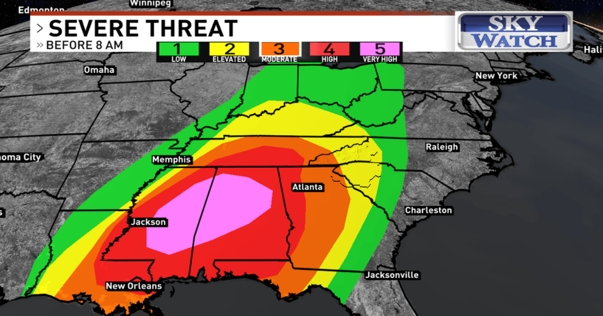
ASHEVILLE, N.C. (WLOS) — Western North Carolina, the Upstate and Northeast Georgia are facing a severe weather threat overnight into the early morning of Sunday, March 16, as a strong cold front moves into the region.
The main threats will be wind damage and tornadoes, with winds already picking up throughout the region.
As of 3:30 p.m. on Saturday, March 15, there is a wind advisory in place for Buncombe, Graham, Haywood, Macon, Madison, Northern Jackson, Southern Jackson and Swain Counties, where residents can expect 20 to 30 mph winds with gusts of 40 to 50 mph expected in the valleys and gusts as high as 70 mph on the high peaks and ridgetops.
The storms are predicted to reach the far western counties around midnight, where the highest risk for severe weather, including tornadoes, exists.
The storms are expected to arrive in the French Broad River Valley around 3 a.m., then progress into the Foothills and the eastern part of the Upstate around 5 a.m.
It is vital to have a reliable way to receive warnings overnight, know your safe location and be ready to move there if a Tornado Warning is issued in your area.
As of 6: 45 p.m., only one WNC county is under a Tornado Watch, which is Cherokee County. The watch is issued until 1 a.m. tonight.
The severe weather threat shifts mostly east of our region after 8 a.m. on Sunday, with Charlotte, Columbia and Greensboro remaining at an elevated risk for severe storms.